Portage, IN to Mishawaka, IN
http://cyclemeter.com/85ef50859d8f1e5c/Cycle-20150831-0903
Trip distance: 66.5 miles
Total trip distance: 2126.5 miles
Average speed: 13.1 mph
Maximum speed: 27.4 mph
Riding time: 5:04
Weather: a warm start of 72° at 9am with a high dew point of 68°. No clouds but hazy. The air warmed up to 85° in the late afternoon and at one point the dew point was 70° - very muggy. Nonexistent to weak south to southwest winds of 3-5 mph helped me a little bit in a few open places.
Terrain: uphill 1883 feet, downhill 1715 feet. The two profiles below show the low elevations associated with Lake Michigan giving way to higher elevations in hillier moraine areas. I included a second profile to show the effect of "stretching out" the profile, and this more truly represents the relatively flat nature of today's ride.
Laura and I have visited the Portage area when we travel by road between the Twin Cities and Pennsylvania. We enjoy hiking at the Indiana Dunes National Lakeshore and on other trails. The route map below shows the National Lakeshore and the
Raisz landform map below shows the extent of the dunes. I didn't visit the dunes this time, but I noticed their impact on the area in that the soil was very sandy. Even at the 32-mile mark, which is about 9 miles from the lake, the soil was sandy. As I moved further away from the lake I traversed moraines and flat valleys, notably the Kankakee Basin, which is labeled on the Raisz map and corresponds to miles 39 to 52 on the profiles above.
 |
| The route map shows a traverse across northern Indiana with a brief visit to Michigan at the 52-mile mark. |
 |
| My route went from a little above and to the right of the "V" hatchmarks which stand for the city of Valparaiso to Mishawaka, which is directly east of South Bend. |
The route was very shady compared to any other day on this trip. On some days in Montana and the Dakotas I had virtually no shade and in Minnesota and Wisconsin I had at most 5% shade on any given day. Today about 25% or maybe even 33% of the route was shaded, which I really appreciated because it was warm and muggy. The high prevalence of shade is due in part, I think, to the sandy soil and in part to the high population density along much of the route. Sandy soil means that the land is not very good for agriculture so there are fewer farms. In prosperous farming areas, farmers tend to clear out most trees, even near the roadside. A high population density means support for creating bike paths and for planting trees along roadways. High population also means that the back roads are more often paved, therefore I don't have to use paved state or national highways which are rarely shaded. Furthermore, this part of Indiana benefits from the economic dynamism of Chicago and is growing in population. Population growth reduces the amount of farmland and often, but not always, adds shady roads.
 |
| A smooth and well maintained bike trail near Chesterton, IN, although the picnic table is not too usable. |
 |
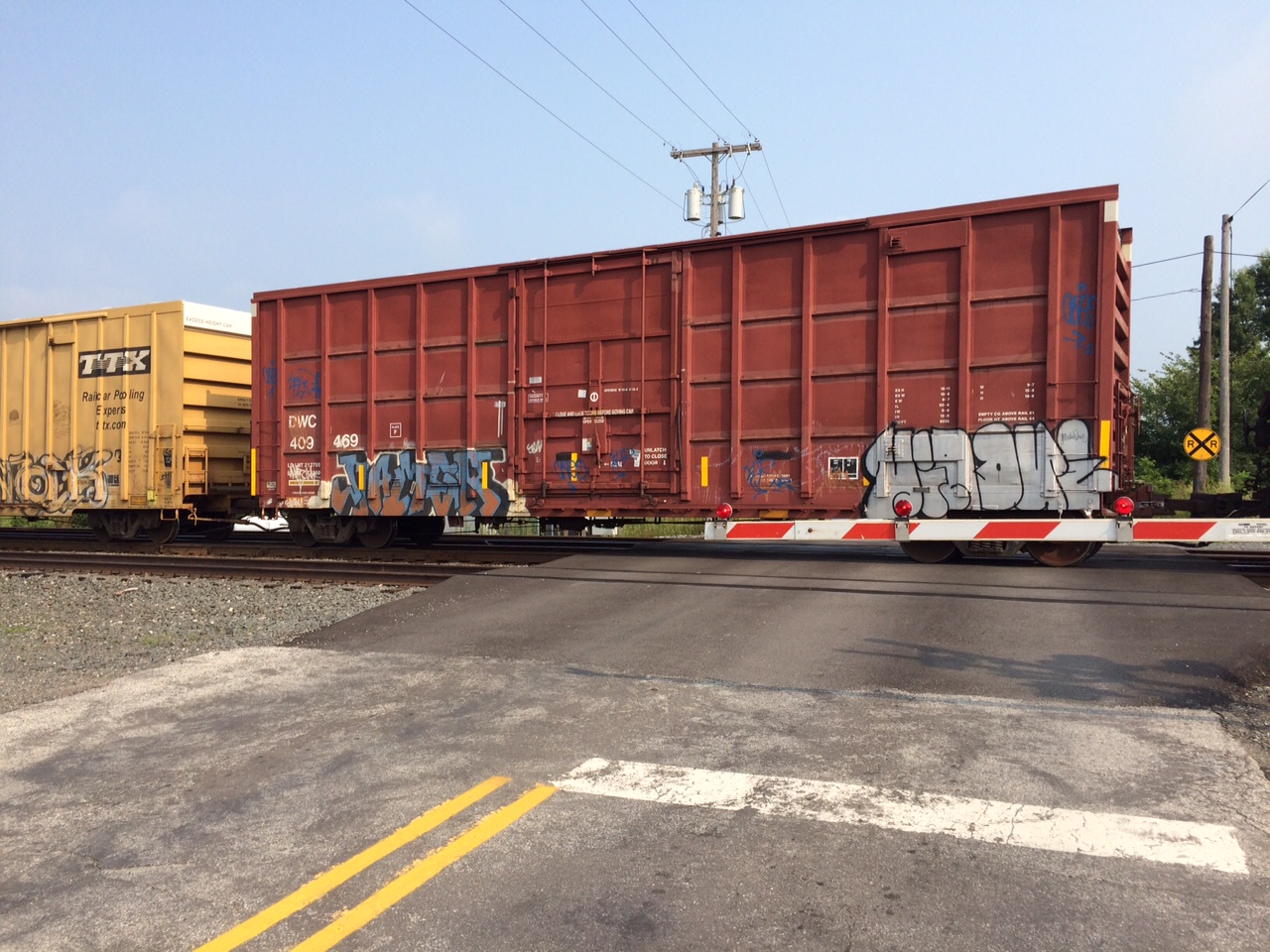
| In Chesterton I waited patiently at this crossing. I knew it would be a long wait because the train began with seven locomotive engines. |
 |
| This big hill surprised me with the suddenness with which it appeared. When I got closer I saw that it was surrounded by a high barbed wire fence. Technically it's a landfill, but because it rises more than 100 feet above the surrounding area, colloquially it's a "trash mountain." |
 |
| The other side of the trash mountain has a facility that harvests methane. This is definitely a worthwhile project, because methane is a potent greenhouse gas and the methane is marketable. |
 |
| Folk art on a barn in Coolspring, IN. |
 |
One of many shady, lightly traveled roads I enjoyed on today's ride. This one is in Coolspring., IN
|
 |
| I go for recycled bicycle sculptures. This one is in Center, IN. |
 |
| This sculpture is presumably by the same person who recycled the bicycle. |
 |
| Dog picture for Cindy and Peter. This big black lab had a fearsome bark but responded positively to my calming words as I took the photo. When I biked away the dog resumed barking and ran a long ways besides me--doing his or her sentinel job well. This dog probably gets a lot of exercise chasing cyclists because of the location on two bike routes. |
Somewhere along this part of the route the soils and topography changed. I like this quotation as an explanation of what shaped the physical landscapes I was passing through here in Indiana and most other states on this trip - except of course for the Driftless Area in Wisconsin: "The simple story of the soils of Indiana is largely one of glacial action. Thousands of years ago great ice sheets hundreds of feet thick spread over most of the state, scraping down hills, filling valleys, and grinding the rocks to gravel and flour. -T. M. Bushnell, The Story of Indiana Soils (1944)."
 |
| My back roads reverie was rudely interrupted by a several-mile stint on US 20. It was busy enough that sometimes both lanes going my way were full, sometimes with trucks. There was not much shoulder either. On the other side of the road is a cornfield--I had seen little corn up to this point. |
 |
| Corn is a globalized commodity. This sign refers to SyngentaAG, a Swiss agribusiness whose biotech corn produced in the US led to China rejecting all corn imports from the US in late 2013. |
 |
| A wheel line irrigates the highway in Olive, IN. I got a little cooler when I went through it. This part of the route is in the very flat Kankakee Basin (see Raisz map above). |
 |
| Roadside memorial in Warren, IN. |
On the final part of my route I went through the suburbs of the South Bend/Mishakawa metro area. Google Maps did a nice job of mostly routing me on quiet residential roads in this area of 300,000 plus people.
 |
| St Joseph River just north of South Bend. A truck on I 80/I 90 is visible through one of the girders in the middle of the bridge. |
I got lucky for dinner this night. A good Lebanese restaurant was a short walk from my motel. The night before I had to make do with an overdressed chef's salad at the motel where I stayed.


Appreciate the picture of the dog. Although, our dogs would never bark....
ReplyDelete