Forsyth, MT to Miles City, MT http://cyclemeter.com/85ef50859d8f1e5c/Cycle-20150806-0936
Riding time: 3:39
Average speed: 13.7 mph
Maximum speed: 38.0 mph
Weather: temperature about 65 degrees at my 9:30 departure and up to 85 when I finished at 3:00. Tailwinds from the west and west-northwest were from 12 - 15 mph all day. There was continuous sunshine.
Terrain: uphill 1306 feet, downhill 1467 feet. The Cyclemeter screencap below shows a cross-section of the landscape: a plateau dissected by stream valleys as well as showing the Yellowstone River bottomlands. When I would finish a climb, I would usually ride on top of the plateau and maintain the same elevation for a couple of miles or more. The lower elevations on the cross section are the Yellowstone River bottomlands. It's easy to see the Yellowstone River on the route map below.


I have used the bicycle layer in Google Maps for almost all of my route planning. The maps showed today's route would be a short one of 50 miles along frontage roads that mostly run parallel to I 94.
After climbing for several miles out of Forsyth I reached the top of the plateau and took advantage of the10 to 15 mph tailwinds. It was easy to average 18 to 20 mph without much effort. Cycling is very quiet with tailwinds. All you hear is the humming of the tires. It kind of feels like flying.
The first town on the route was Rosebud. As in the case with many towns on this trip, the first letter of the town is painted white on concrete or something high up on a nearby hill.
 |
| "R" stands for Rosebud, MT. |
Cottonwood trees do very well in the semi arid climate in this region. Precipitation is about 12 to 15 inches per year, and cottonwoods seem to do well even when they are not near streambanks.
 |
| A large cottonwood in Rosebud. My bike at the base of the tree provides scale. |
Along my route is dryland agriculture on the plateau and irrigated agriculture in the Yellowstone River bottomlands. The land in between on the hills is mostly scrubland with lots of sagebrush.
 |
| High plains perspective. The huge wheat field, power lines, roadside vegetation, and the road almost meet in a vanishing point. |
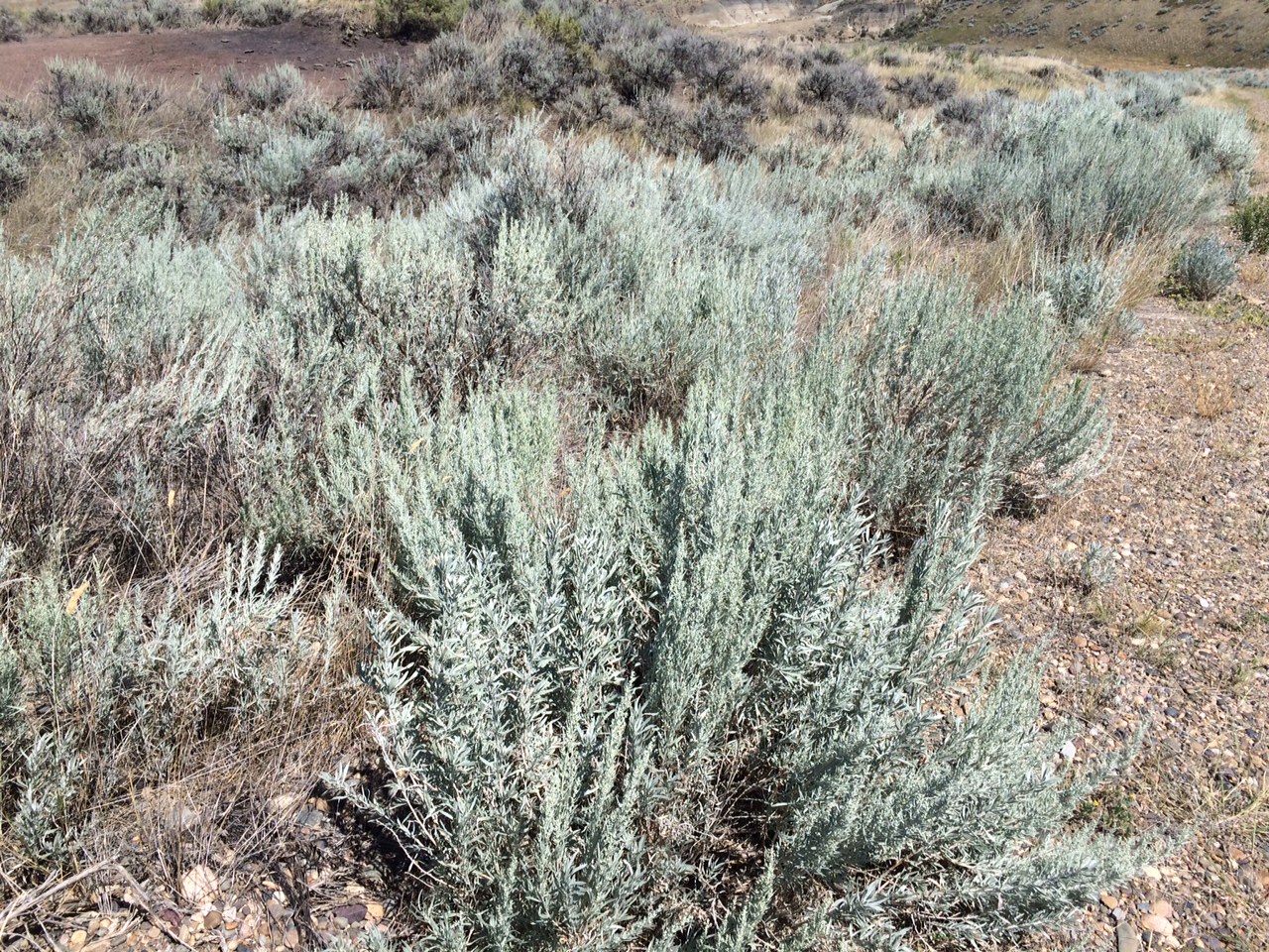 |
| Sagebrush is common on the nonagricultural land between the plateau and bottomlands. Sagebrush is not the same as the herb sage and it has no culinary uses. |
About halfway through the route I approach Hathaway.
 |
| What will I find? |
 |
| This is all of Hathaway. The view is from the I 94 Hathaway exit. |
A close-up view reveals what Hathaway is like: in ruins.
 |
| Hathaway's housing. |
 |
| Hathaway's mobile home. |
Hathaway is on the railroad.
 |
| The BNSF Railroad runs through Hathaway. A worker who was part of a crew doing some drainage work for the one existing ranch in Hathaway snapped my picture. |
My navigational problems began in Hathaway. I thought I had inspected the Google maps closely ahead of time but I did not realize that it had inadvertently routed me on I 94. After 5 miles on the freeway I exited as per Google's instructions and then I got puzzled again.
 |
| Google Maps had me facing two lanes, both of which say "do not enter." There is a gravel road up on the left and that must be what Google Maps calls the frontage road. I recheck with Google, which tells me to walk my bicycle, as the screenshot below indicates. |
 |
| Google Maps screenshot. It's the first time I have seen it tell me to walk my bicycle. |
I am now confronted with a locked gate. My friend Tom Daddesio calls me a person of extreme moderation, so I lift my bike over the locked gate and proceed.
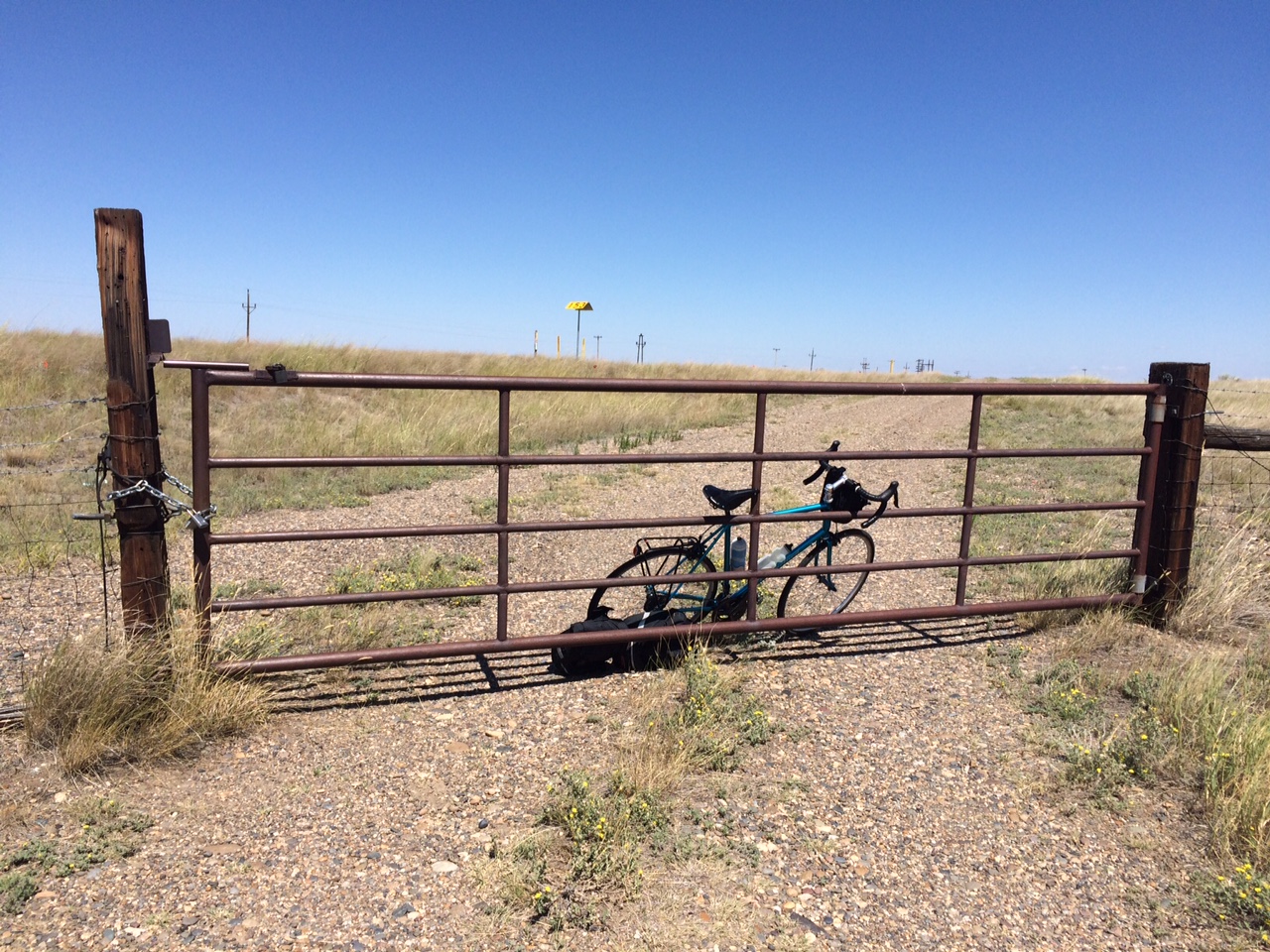 |
| I crossed the locked gate so that I can proceed on the frontage road, or at least that's what Google calls it. |
It is surprising to me that this frontage road does not have a single trace of asphalt but my phone shows that I am exactly on the route that Google has charted.
 |
| Frontage road, according to Google Maps. |
As I ride carefully along the gravel road I see some beautiful scenery. Also I begin to see a little bit of asphalt on the road here and there.
 |
| Bluffs and protruding resistant rock. |
 |
| View of the Yellowstone River. |
As I leave this segment of the route, I go through a gate saying that people need a permit to be in this area and that violators will be subject to prosecution.
 |
| Permit required. |
I will notify Google that their bike map for this area needs revision. On a previous trip Tom and I made from Mercer to Chautauqua Google routed us through a military base. I contacted Google about it and they later corrected it and thanked me. A couple of hours later I learned why the frontage road I rode on had so little asphalt. I happened to speak with a rancher at the Miles City Dairy Queen. The frontage road was old US 10, and when I 94 came in the highway department ripped up all the asphalt and recycled it for use on other roads in the area.
In Miles City I saw another meth awareness sign. An article I read in the Missoula newspaper said that meth use is down but that it has been replaced by prescription painkillers and more recently by heroin.
 |
| Meth sign showing a skeleton on a bucking bull. |
And that's it for Day 12.
Sounds like a pretty difficult day. I'm emailing you our picture of Hathaway, Mt, (in 2001) which almost looks like it could be the building on the left in your "Hathaway housing" Mary H
ReplyDeleteThat segment of 5 miles or so toward the end was indeed difficult although rewarding. The rest of the day was not so bad. I agree, it is the same house. Hathaway has deteriorated in the last 15 years!
DeleteI wait every day for a post. Still unbelievable! I could never ever do what you are doing? Nice work!
ReplyDeleteThanks for your comment. It does seem unbelievable in some ways to me too. I will add, though, that I could not play pickle ball five days a week and play tennis several times. My body could not stand it!
ReplyDeleteHappy 64th Birthday Jimbo! I have so been enjoying your blog through MT. All those familiar sights. Sorry not to comment sooner, but we have been very busy dealing with "it". I can't believe you are getting up so early without Tom cracking the whip. We will be thinking of you tonight when we are celebrating Tom's birthday on the deck! Pam MacDonald
ReplyDeleteBD#2 The days listed in the contents seem to be out of order for me. I posted the following on a different day *smile* The last several days mostly follow a route you traveled, in a car, back in the late 90s when you traveled to White Sulphur Springs with us. Also, Happy Birthday old guy on a blue bike. This will be your last power of 2 birthday (2 raised to the power 6). I think Paul McCartney wrote a song about this day. Sounds like a great Journey. -- BD#1
ReplyDelete