Pepin, WI to La Crosse, WI http://cyclemeter.com/85ef50859d8f1e5c/Cycle-20150824-0803
Distance: 82.9 miles
Total trip distance: 1681.7 miles
Average speed: 14.9 mph
Maximum speed: 25.1 mph
Riding time: 5:34
Weather: It was about
58° when we started at 8am and was mostly in the high 60s. Skies were mostly cloudy.The wind began strong at 10 mph from the north and northwest and averaged about 10-15 mph throughout the day, with higher gusts. Our ride headed southeast, so we had excellent tailwinds.
Terrain: uphill 1210 feet, downhill 1311 feet. Our route stayed close to Lake Pepin and the Mississippi River, so there was not much climbing as indicated by the cross section below. Elevations stayed between 600 - 750 feet.
Tom and I began our second day of riding from Pepin, WI and eventually reached the north side of La Crosse. After all our years of touring, we still make navigational errors. At the 49-mile mark on the route map below, we continued straight when we should have gone right so that we would reach Trempealeau, which is at the 59-mile mark. We therefore added about 6 miles to our route, and had to fight a strong crosswind to boot. There is a smaller deviation from our intended route at the 74-mile mark which cost us about 3 extra miles. Oh well.
 |
| The one large "Z" shaped deviation and a smaller "C" shaped deviation below it show our inability to read maps :( |
Our route took us over the Chippewa River, to Nelson, WI, past impressive bluffs, and to Alma, WI. The large amount of sediment deposited by the Chippewa into the Mississippi River caused a backup of water that formed Lake Pepin.
 |
| Sediment from the Chippewa River helped create Lake Pepin. |
 |
| Firefighter and bike rider in Nelson, WI. |
 |
| The Mississippi River valley is defined by bluffs from 200 to 600 feet high on each side of the river. |
 |
| Bluff near Nelson, WI. |
 |
| Downstream view of Lock and Dam No. 4 at mile 752.8 of the Mississippi, River at Alma, WI. In 2001, we photographed this lock and dam from upstream. |
 |
| Power to the people. The huge Dairyland Power Cooperative power plant at Alma, WI. |
 |
| The Dairyland Power Cooperative power plant burns coal brought by river barge. |
A little ways past Alma we stopped for a snack and two bike riders from Sheffield, England saw us and stopped to chat. A couple in their early to mid 30s, they had begun a tour of North America last February. They have biked an extraordinary 7,000 miles so far. Starting on the west coast, they have visited, among other places, Utah, Montana, the Yukon, Saskatchewan, North Dakota, Minnesota, and Wisconsin. Future destinations include Columbus, OH and Toronto, Ontario. As with several other cross country cyclists that I have met on this trip, they sometimes make use of Warm Showers, a free worldwide hospitality exchange for touring cyclists.
The two Sheffield riders have ridden 7,000 miles on fully loaded, sturdy touring bikes with four panniers on each bike. They each had a pair of Crocs attached to one of their panniers. His bike and gear weighed an astonishing 110 pounds and her bike and gear weighed almost as much at 102 pounds. The bikes did not have fat tires, but their tires were not skinny like ours either. They did not train for the trip and in the first weeks they averaged 40-50 miles per day, and then 60-70 miles a day, but on several occasions they have topped 100 miles, once reaching 115 miles. It was easy to believe that they could ride 100 miles, because we later noticed that their touring speed nearly matched ours, and our bikes weigh about 45 pounds each with gear. We were awed by their achievement.
 |
| The two cyclists from Sheffield, England in front of Tom have logged an amazing 7,000 miles on their tour of North America. |
Toward the end of our ride we went by the Trempealeau National Wildlife Refuge, the village of Trempealeau, WI, and the city of Onalaska, WI.
 |
| In the background is a slough at the Trempealeau National Wildlife Refuge. Mississippi River valley bluffs in Minnesota are in the distance. A slough is typically used to describe wetlands. Sloughs along the edges of rivers form where the old channel of the river once flowed. |
 |
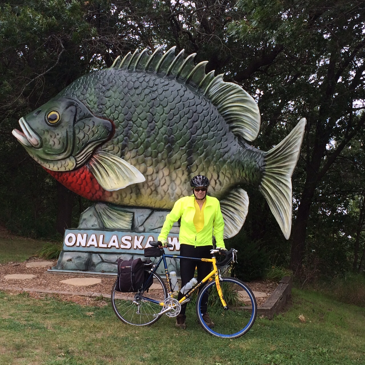
| Big fish. |
 |
| Another big fish. It has been here since at least 2001. |
We arrive at our destination of La Crosse in the late afternoon. The name originated from the game with sticks that resembled a bishop's crozier or la crosse in French, which was played by Native Americans there.
 |
| La Crosse players. |
 |
Somebody else's winter picture shows the La Crosse welcome statue in detail.
|
Below is the wind record for Alma, WI for the day. I chose it as representative for the day's winds. The red line on the wind speed chart shows winds of 10-15 mph, and the blue squares show gusts up to 25 mph. The other chart shows north and northwest winds that blew at our backs. The wind helped us reach an average speed of 14.9, which I believe is the second fastest average we have had on any trip. In our 2005
South Dakota - Minnesota tour, we average 16.1 mph for the second day. Tom said that at our age the average speed should get a multiplier. Any way you look at it, it was a win-wind situation.


No comments:
Post a Comment