Trip distance: 72.0 miles (includes several miles of evening errands)
Total trip distance: 1906.9 miles
Average speed: 12.2 mph
Maximum speed: 24.7 mph
Riding time: 5:53
Weather: at the 8:10 start it was 59° with a dew point of 55°. The temperatures were in the 60s and reached the low 70s for a little bit. It was sunny all day long. Winds were mostly south for the day, varying from 3 to 8 mph.
Terrain: uphill 1314 feet, downhill 1451 feet. The route passed through a glaciated area of low hills and plains. The low point on the profile at the 40-mile mark is the Rock River. The route map below the profile shows numerous lakes created by glaciers.
Terrain: uphill 1314 feet, downhill 1451 feet. The route passed through a glaciated area of low hills and plains. The low point on the profile at the 40-mile mark is the Rock River. The route map below the profile shows numerous lakes created by glaciers.
 |
Route map generated by my Cyclemeter phone app.
|
After about 12 miles I left the Madison metro area and I passed through farmscapes and agricultural service centers as well as lakes and resort oriented districts.
 |
Madison has lots of bike-oriented infrastructure, including bike lanes and bike/pedestrian overpasses over busy roads. This picture shows a small bit of the Capital City Trail.
|
 |
Horse farm on the outer edge of the Madison metro area.
|
 |
Nice stand of chicory, a common and pretty roadside plant.
|
 |
One of several tobacco fields near Albion, WI. Tobacco production is down from 38,000 acres in 1938 to maybe 1,000 acres today. I saw quite a few dilapidated tobacco barns.
|
 |
Tobacco leaves are hanging in the barn in a farm near Albion, WI.
|
 |
This picture includes the barn shown in the previous picture. This picture shows another drying barn to the left. Judging by the appearance of the house, this farm looks prosperous.
|
 |
Soybean field near Albion. The few stray corn plants suggest a field in a corn/soybean rotation. Soybeans enhance soil fertility by fixing atmospheric nitrogen. The trend in some parts of the country has been to plant continuous corn because of economic considerations although environmentally it's probably a bad idea.
|
 |
Angus in silhouette.
|
 |
Barn and yard with eye catching ornamentation. Near Avalon, WI.
|
 |
Biking down this road I was astonished to see the amount of hay stored in these hoop-shaped sheds.
|
 |
It then became apparent that it's a huge dairy operation.
|
 |
The main entrance to Rock Prairie Dairy is on US 14. This Wisconsin State Farmer article describes the operation favorably.
|
I reached my destination of Delavan, WI in the late afternoon. Its motto is "19th Century Circus Capital of America." A plaque on an elephant statue notes that Delavan was home to 26 circus companies between 1847 and 1894.
 |
Some little girls horsing around on a giraffe statue in Delavan. The statue memorializes the town's circus heritage.
|
 |
Two girls clowning around for a friend on another circus statue in Delavan.
|
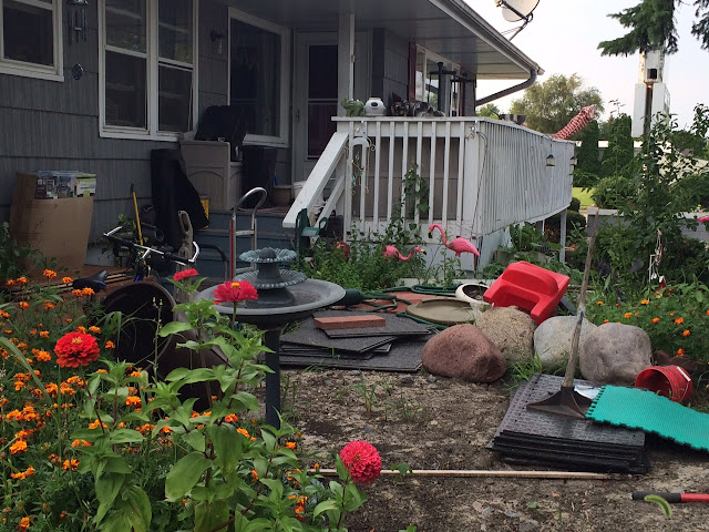
I stayed at the Evergreen Motel in Delavan. The motel property was a little unkempt, but I love a place with pink flamingos.


You are really flying along! I am really enjoying your story. Looks like you will make it home in time.
ReplyDelete