Friday, July 31, 2015

Day 5, July 30: bicycle oasis

Arlee - Missoula http://cyclemeter.com/85ef50859d8f1e5c/Cycle-20150730-1012
Distance: 38.0 miles
Riding time: 3:34
Average speed: 10.6
Maximum speed: 25.8
Weather: low 60s in the am, low 90s in the afternoon, bright sun all day, 10 mph headwind from the south in the morning shifting to a west tail wind of 5 - 10 mph in the early afternoon.
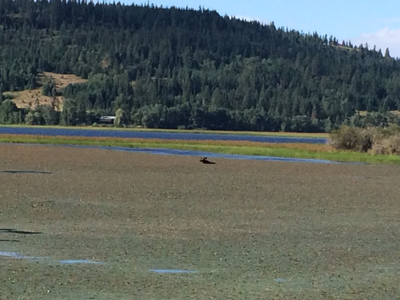
Terrain: uphill 1622, downhill 1728. The profile shows a big climb and a long descent.


There was a gap in the motels in this part of Montana so I had a short day of riding. On the way to Missoula I saw an animal bridge over the highway. The short ride gave me some time to appreciate Missoula, a very bike friendly city with a mellow vibe. Missoula is a college town and it has put major bike infrastructure in place. I probably won't see so many bikes until I reach Minneapolis.


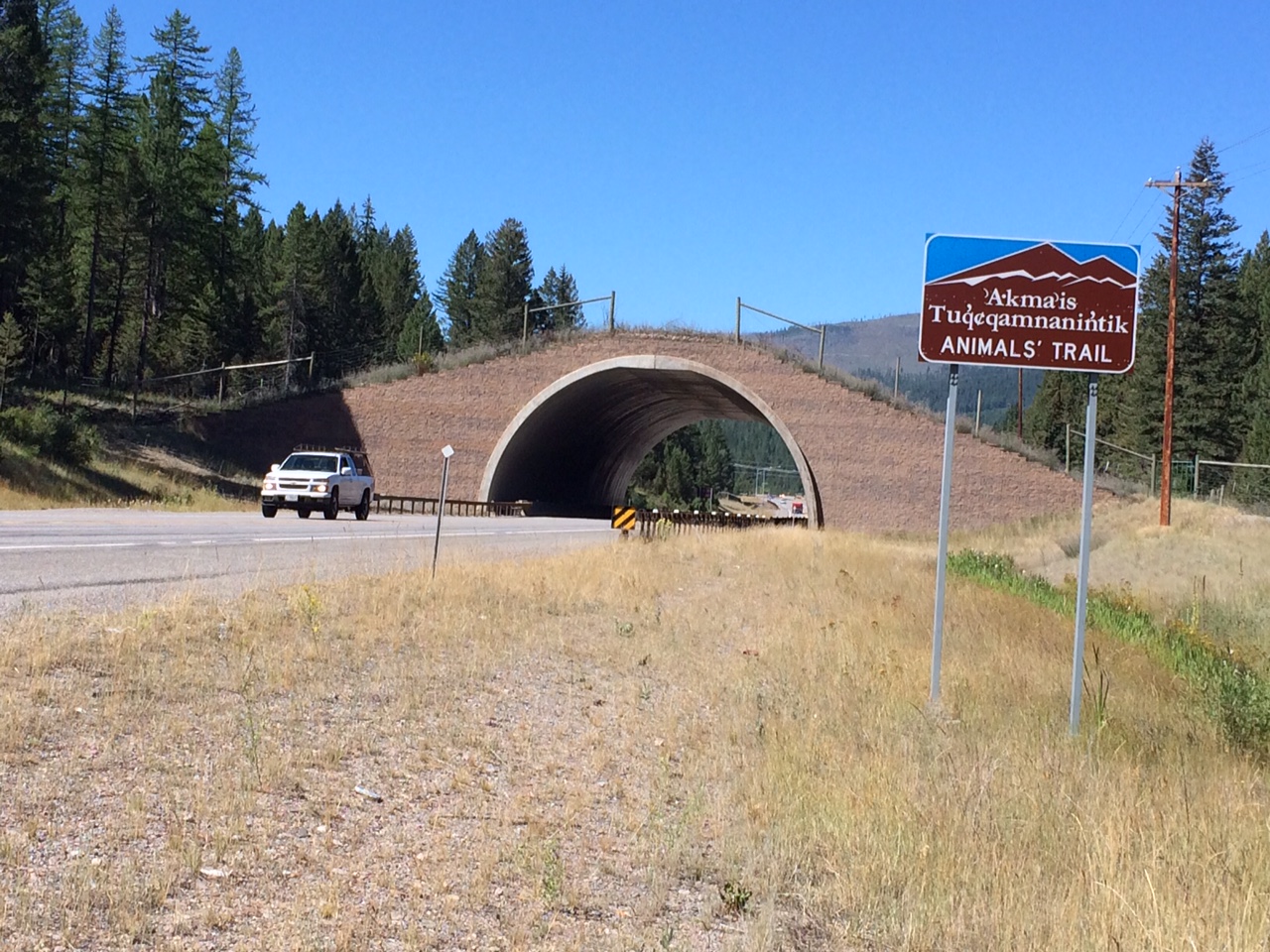
The Flathead Nation built an animal bridge over US 93/MT 200.

The picture shows a grizzly statue, the University of Montana's oldest building, and a big white "M" on the hillside above.

The Missoula Bicycle/Pedestrian Office's mission is to reduce single-occupant motorized vehicle use and enhance non-motorized transportation options.


Thursday, July 30, 2015

Day 4, July 29: taking it really easy in Arlee

I stayed with Charlie Pile and Laurie Bogart at their house near the Jocko River and near one of the smaller mountain ranges of the larger Mission Range. Charlie is the younger brother of my University of Minnesota graduate school friend Deb Pile. Charlie and Laurie both have jobs in Missoula and they they do organic farming in their spare time on their 20 acres of land. They live on the Flathead Indian Reservation.

The screenshot of Google Maps shows the location of their house. The small gray circle in the lower left shows the location of their house.


Here's a picture of their house, with a couple of early 1960s Cadillacs in the foreground.


Laurie looks into the late afternoon sun. There's a partial view of Sidney, their Akita.


All 100 plus pounds of Sidney.


Charlie and Laurie have apricot and apple trees in their orchard.  Apricot trees can produce fruit in just three years after planting.


Wednesday, July 29, 2015

Day 3, July 28: terrific progress and harmonious brilliance

Distane: 87.5 miles
Average speed:14.3 mph
Maximum speed: 32.8 mph
Riding time: 6:07
Weather: 45° and foggy when I started, reaching the mid-80s by the afternoon. Bright sun in the morning and partly cloudy in the afternoon. Not much wind in the morning but a terrific 10 to 15 mph tailwind in the afternoon.
Terrain: uphill 3489, downhill 3120. The route followed four river valleys: an amazing 17-mile downhill on I 90 by the St Regis River, a descent on MT 135 along the Clark Fork River, a descent on MT 200 near the Flathead River, and then a climb starting at about the 60-mile mark along the Jocko River valley on MT 200 and Jocko Canyon Road. The profile of the route is shown below as is the route map from my Cyclemeter iPhone app.


Brrrrh! A very chilly 45° when I started riding. I put on all four of my bike shirts and a jacket and two sets of leg warmers, and this worked fine although my fingers were a little cold for an hour or so. This reminds me of the time when my bike partner Tom MacDonald was an undergraduate. We were at some friend's house in a three-story brownstone walk up near Franklin Avenue in Minneapolis. Much to the amusement of the group there, Tom put on every single item that he could that was in the closet. I think they were women's clothes.

The first 15 miles were on I 90 and almost all of those miles were downhill. It was actually a beautiful ride. There was very little traffic, it was foggy and still, and there were frequent views of the St Regis River rushing through Ponderosa clad steep mountains.

The St Regis River near I 90.

The sun burned off the fog as I traveled down I 90.


Panorama of the Clark Fork River as it runs along MT 135.
The Flathead River has whitecaps, evidence of the tailwinds that blew me along at a nice clip for awhile.
Homemade irrigation system drawing on the Flathead River near Plains, MT.
Irrigation sprinklers in action on the other side of the road from the previous picture.
Automobile fatality shrine on MT 200.

More automobile fatality shrines along MT 200.
The Jocko River is on the left. MT 200 runs to the right of the tall fence. I assume the fence is there to prevent deer and other 
animals from crossing the two-lane highway, which has a 65 or 70 mph speed limit.
Erin (on left) and Courtney from Seattle have been riding through Oregon, Idaho, and Montana for about three weeks. I helped them repair a flat rear tire. They are not afraid to get their hands dirty.

I got off the main road to visit The Garden of One Thousand Buddhas.
This mailbox a short distance away from The Garden of One Thousand Buddhas doesn't quite fit in with the Garden's ideals of joy, compassion, and wisdom.
A panoramic view of the Garden of One Thousand Buddhas shows part of the garden, some of the statues, and the central pavilion.

The pavilion shelters the deity Prajnaparamita, a female supernatural being who advocates wisdom through realization of the
"empty," or ephemeral nature of the sensual world.
Detail of the deity Prajnaparamita,
This statue is labeled Terrific Progress.
Plaque showing title, parentage, and other information about Terrific Progress.
Plaque showing title, parentage, and other information about Harmonious Brilliance.


Tuesday, July 28, 2015

Day 2, July 27: from bikeway to freeway


Harrison, ID - Haugan, MT http://cyclemeter.com/85ef50859d8f1e5c/Cycle-20150727-0734
Distance: 78.2 miles
Riding time: 6:10
Average speed: 12.6
Maximum speed: 25.5
Weather: 50° at 7:30 warming to the low 60s; alternating sun, clouds, with a little light rain that I avoided by waiting a few minutes. I did see a bank thermometer dropped from 60° to 56° in two minutes when some rain came through. In the afternoon and a tail wind of 10 mph came out of the west southwest.
Terrain: uphill 3026, downhill 3389. The route profile below shows an uptick at about the 63-mile mark - this is explained toward the end of this post. The profile also shows an extraordinary 15-mile downhill, the longest of my life.


My route is shown below. I followed the Trail of the Coeur d'Alenes bike trail for the Idaho portion of the ride. After the gap in the route, the segment on the right is in Montana.


Chain of lakes panorama. The Trail of the Coeur d'Alenes bisects the photo.
Moose in the water.

By about noon the Trail of the Coeur d'Alenes is drying out. This section is near Cataldo, ID.

Coeur d'Alene River, near Cataldo.

Couer d'Alene River.

The South Fork of the Couer d'Alene River, near Kingston, ID.
Space age styling in Wallace, ID. The white and red sphere in the center is a space capsule that you can sit in.
Suspended bicycles in Wallace, ID.
A changer in the weather. I had to wait a few minutes before returning to the trail.

At the 62-mile mark I got off the bikeway and onto the freeway for the final part of the day's ride. Many cross country bike riders doing a northern route across the US follow US 2, which runs close to the Canadian border, but I was taking a more direct route across Montana to the Twin Cities in Minnesota, so my intended route followed US 12. This route would save me two or three days of riding. This meant that I had to ride on I 90 for about 30 miles. More than a dozen states permit bicyclists on interstate freeways outside of urban areas or on at least some interstate routes specially designated to accommodate bikes.

I was steeling myself for a big 5-mile climb of 1,500 feet on I 90 up Lookout Pass but then I saw the sign below at the beginning of the hill. I called the number and 5 or 10 minutes later a highway employee drove me to the top of the hill in a van. This portion of I 90 was undergoing repair and there was not enough room for traffic and bicycles. 

My Cyclemeter app did not record any movement of my bicycle when the van carried my bike and me up the big hill.
The 15-mile downhill was a bit tense for me a few times because of several pulses of fast moving, heavy traffic and of accumulated grit on the shoulder but mostly vehicles moved over to the left lane giving me plenty of room on the wide shoulder.


Day 1, July 26: the city and the country

I plan to post a few highlights each day, and if I have time I will add more material later. The mobile Google Blogger app only permits low resolution photos, although I have sometimes uploaded higher resolution photos when I have access to a computer.

Distance: 64.3 
Riding time: 5:21
Average speed: 11.9 mph
Maximum speed: 29.1 mph
Weather: 60° in the morning, sunny, headwind from south 8-10mph. In the afternoon temperatures were in the high 60s. It was still sunny, but the wind shifted , giving me a 10 mph tailwind from the west.
Terrain: uphill 2453, downhill 2140. The flat segment at the end of the route profile is the bike trail along Coeur d'Alene Lake.


My route went through the eastern side of the Spokane Metropolitan Area, the wheat and grass country of the eastern edge of the Palouse region, and recreational areas around Lake Coeur d'Alene. A dashed north-south line depicts the Washington/Idaho border on the route map below.

A screen capture of my route overlaid on a Google Map in Terrain view. My Cyclemeter phone app records ride data and route maps. 

The start of a trip is a joyous occasion.


The fertile lava-based soils of Washington's Palouse region produce wheat and grass. A man in the local history museum at Rockford, WA told me that after the Mount St. Helens eruption in 1980 many local farmers were worried because of the thick layer of ash deposited on their fields but instead they got two of their best years ever. 
Palouse wheat.
A local history museum in Rockford, WA has a fascinating quilt depicting various aspects of places in the region.

Crossing the line.
Heyburn State Park on Lake Coeur d'Alene.
Bicycle bridge in Heyburn State Park.

Bicycle bridge in Heyburn State Park, closer up. This bridge is in the westernmost part of the beautiful bike trail called Trail of 
the Coeur d'Alenes.

Two cyclists enjoy the Trail of the Coeur d' Alenes (they are to the left of the bridge).