Tuesday, August 4, 2015

Day 8. August 2: US 12 closed . . . but not for bicyclists

Townsend to Harlowton http://cyclemeter.com/85ef50859d8f1e5c/Cycle-20150802-0832
Distance: 98.8 miles
Riding time: 8:17
Average speed: 11.9 mph
Maximum speed: 29.9 mph
Weather: middle 60s, blue skies with some cirrus clouds; by afternoon it had reached the low 90s, as seen in the screencap below. Weather Underground put the visibility at 10 miles - not because of water vapor in the air as the dew point was only 47° but because of forest fire smoke in the region. For example, parts of Glacier National Park are closed because of fire. The screencap shows an ENE 13 mph wind that was close to a dead-on headwind for me. In the morning there was no wind, and after that a headwind until about 3:00, followed by a tailwind, and then the 13 mph headwind. This wind direction variability has been typical of the trip. Wind direction seems to change from one valley or basin to the next depending on the configuration of the local mountains.

Weather Underground phone app screencap.

Terrain: uphill 4085, downhill 3518. This was a challenging day. I went about 99 miles, began with a 25-mile climb up some foothills and Deep Creek Canyon, and I had some brisk headwinds toward the end of the day. These Montana hills and mountains have gentler slopes compared to those Tom and I have done on our Pennsylvania rides. The accumulated uphill climbing and downhill gliding here in Montana is less than that of Pennsylvania rides too. The 4100 feet uphill I did for this day will be one of the biggest climbing days of the trip but this is much less climbing, for example, than an average day on the Mercer to Washington DC ride Tom and I did. We climbed 31,600 feet in four days (see tmacd.com).


The route followed US 12, US 89. MT 294, and then US 12 again.


Irrigation wheel line just east of Townsend.
Irrigation wheel line just east of Townsend on US 12.

A snake sunning itself on the side of the road. It is probably a bull snake instead of a rattlesnake because there is no rattle at the end of the tail. I assumed it was a rattlesnake at first so I gave it wide berth and used the zoom feature on my phone camera.

Probably a bull snake.

I saw a sign saying that US 12 was closed at Deep Creek Canyon ahead. The next warning sign repeated the message but added that there was a motorcycle advisory. Then three motorcyclists passed me, and a few minutes later they came back, most likely having been turned away. This gave me pause. I reached the work zone and the guy I talked to didn't want me to go through. He said it was a cluster**** up there, that there were machines everywhere, and that the road was all torn up. I persisted, and he said that if I had to go, I could go.


Road closed . . . but not for bicyclists.
The work area was a busy scene. About two dozen people were working on a bridge, on a Sunday. I walk around and through without disrupting their operation. Then I had the whole highway to myself.

US 12 bridge repair in Deep Creek Canyon.

The construction zone lasted for another 8 or 10 miles past the bridge, and it was uphill all the way. I got partly distracted from the work of climbing because it was a beautiful V-shaped valley with many views of Deep Creek. At the top I got a view of the mountain that still had some snow on it.

There's a snowfield in the far distance above the short pine trees in the center of the photo.

Long straight road.

I followed US 12 to US 89, and then headed east on MT 294, where I had my first really bumpy road on this trip. Lots of cracks in the road for about 5 miles.  This highway traverses cattle country and an occasional horse farm.

Angus in silhouette (this phrase is borrowed from William Nutter's "Directions in the Nebraska Sand Hills."

More quadrupeds.
For the last segment of the ride I faced a pretty stiff headwind. The tattered conical textile tube below indicates a wind of at least 10 mph.

 A wind sock provides an approximate measure of wind speed.
There were no services whatsoever on this ride until the 70-mile mark when I reached the Crazy Mountain Inn in Martinsdale. This was the first day that I needed to drink from my 4 liter bladder (stored in a pannier) after finishing my two quart water bottles held in cages mounted on the bike frame. Snacks tided me over until I had a nice chef's salad and rhubarb pie à la mode. Despite the somewhat ragged appearance of the exterior, the Inn has good food. On one wall, they have the beautiful Raven Map of Montana (the link points to a zoom-able map)

Martinsdale had 64 people in 2010. Most buildings are vacant, such as the former Heath Hotel. Martinsdale maintains a Post Office and the Mint Bar.

Crazy Mountain Inn, named after the nearby Crazy Mountains. 
The former Heath Hotel on Martinsdale's Main Street

Two Dot is a few miles from Martinsdale. Both towns were station stops on the now-abandoned transcontinental main line of the Chicago, Milwaukee, St. Paul and Pacific Railroad ("the Milwaukee Road"). Two Dot has fewer people than Martinsdale. It supports a bar and a post office. Two Dot is named after a local rancher whose nickname reflected his distinctive cattle brand.
Two Dot Bar

A fierce guard kitty at the entrance of the Two Dot Bar, but she let me pet her.

On the final leg I saw several clusters of wind turbines. They made me think of Deb Pile who will soon retire from her job with the MN Department of Commerce where she works on the permitting of wind turbines and associated issues.

Thirteen wind turbines along US 12.
I pulled into my destination of Harlowton, or Harlo for short. I soon met Karen Hammel, a recently retired attorney who worked for the MN Attorney General's Office and is a friend of Deb's. Karen represented Deb's division. Karen gave me a couple glasses of water and then we enjoyed a beer sitting on her porch that overlooks tiny Jawbone Creek and a vast pastoral landscape with mountain ranges in the distance.


Monday, August 3, 2015

Day 7, August 1: pickleball is everywhere

(medium resolution photos)

Lincoln, MT - Townsend, MT http://cyclemeter.com/85ef50859d8f1e5c/Cycle-20150801-0818

Distance: 93.9 miles
Ride time: 7:24
Average speed: 12.6 mph
Maximum speed: 32.0 mph
Weather: at 8:15 it was 55° and reached the upper 70s by noon and low 90s by the afternoon. The wind was variable although there were headwinds of 5 to 8 mph in the early afternoon and tailwinds from the west and northwest of 10 mph with higher gusts.
Terrain: uphill 3576, downhill 4223. The route profile shows a 2000 foot ascent and descent from about mile 10 to mile 30 and then smaller hills for the rest of the day with several having 500-foot ascents and descents.


I left out the final two miles to Townsend, MT in order to show the remainder of the route in greater detail.


I left Lincoln and within a mile was disappointed to see that the road turned to gravel. There was no alternative so I continued, slowly, on the long and winding road for 14 miles, to the top of Stemple Pass. During this stretch one car passed me and seven came from the other direction. On the way down, two cars passed me and five approached me. When I stopped for rests, I heard birdsong and water flowing in the creeks; at other times it was absolutely dead quiet. In this remote area my mind turned occasionally to the prospect of me being tasty food for some grizzly bear with humongous claws or a black bear (you distinguish the two by the size of the claws and head shape, among other things). A person confronted with a grizzly is supposed to avoid eye contact and back away, while with black bears you should engage in threat displays. The chances of seeing a bear are remote. I saw bear prints in the mud of a stream bank a few days earlier. In Arlee, Charlie Pile and Laurie Bogart's bear proof waste bin had bear scratches on it, although Charlie had never seen a bear in many years of hiking and hunting. This all reminds me of point my PhD advisor, Yi-Fu Tuan, made in the early 1970s. At the time, it was common to romanticize nature and wilderness, but Tuan pointed out that for many indigenous peoples, nature was a fearsome thing, something like a live power wire that could hurt you if you were not careful.

The trees in the foreground are suffering from bark beetle damage while the forest in the background is not.
Close up view of pines suffering from a bark beetle infestation.
Long and winding gravel road.


Stemple Pass at 6,388 feet is the elevation high point of my trip. The pass sits astride the Continental Divide. Water flowing down one side drains into the Gulf of Mexico, and on the other side, water goes to the Pacific Ocean.
The small hamlet of Canyon Creek is between Stemple Pass and Helena. I stopped for an ice cream bar at the Canyon Creek Country Store and Post Office shown below. The woman who runs the place asked about bicycle clothing and then she mentioned something she likes to wear while playing pickleball. I said, "did you say pickleball"? She is a fanatic who has been playing in Missoula and Helena for 8 years. Many of you know that Laura and I have become pickleball addicts. My pickleball friends will not be surprised to hear that this woman asked if I had packed my pickleball paddle in my pannier. Packing a paddle seems like a perfectly logical thing to do if you are a pickleball fan, but I had not. Maybe next time.

The manager and postmaster at the Canyon Creek Country Store is a pickleball fanatic.

"Share the road" is a great idea, especially with a shoulder like this one. It is not detectible in the picture below, but the sign to the right of the pickup truck posts a daytime speed limit of 70 mph, and the sign behind it posts a daytime speed limit of 60 mph for trucks.

Sharing the road is harder when the shoulder is narrow.


I pedaled against 5-8 mph headwinds on my way south to Helena. Helena is a railroad town and is the state capital (two pictures below).

Railroad facilities in Helena.

Montana state capitol.

The winds shifted as I left Helena. They mostly blew behind me and toward the end of the ride I enjoyed one of the great thrills of bicycling, a four-mile glide down a gentle hill while taking in big panoramas, as seen in the photo below of a Missouri River reservoir. After the downhill, I saw an elaborate double automobile fatality memorial. The following two photos are from the US 287 bridge over the river.

Canyon Ferry Lake is in the distance. It is a Missouri River reservoir.
Automobile fatality marker and bridges over the Missouri River. In the upper left background is a green sign identifying the Missouri River. 
The Big Muddy, looking upstream from US 287.


The Big Muddy, looking downstream from US 287.


I reached my destination, the small town of Townsend (population 1,900). Along the main street is a mural by young people showing signature scenes of the local geography, including snow capped mountains, an irrigation wheel line, irrigation channel, two abandoned silos, barns, as well as a school, church, and house.

Townsend mural showing local scenes.

I ended my day at the Mustang Motel.


Saturday, August 1, 2015

Day 6, July 31: a ride like today's comes only once in a blue moon

(low resolution photos)

Missoula, MT to Lincoln, MT http://cyclemeter.com/85ef50859d8f1e5c/Cycle-20150731-0859
Distance: 81.5
Riding time: 6:01
Average speed: 13.4 mph
Maximum speed: 31.2 mph
Weather: 62° when I started at about 9 o'clock going up to the low 90s in the afternoon with some cirrus clouds in the morning and almost no clouds in the afternoon. Winds were variable at about 5 mph from the south and west, so I had some mild crosswinds and tailwinds.
Terrain: uphill 3424 feet, downhill 2103 feet, the route profile below shows a gradual climb


Today's route was very easy to navigate. I took Montana 200 all the way from Missoula to Lincoln. It is a smooth, 2-lane road with a speed limit of 70 miles mph for cars and 65 miles mph for trucks. Fortunately the shoulder was wide for most of the route. Today I got many nice views of the Clark Fork and Blackfoot Rivers.


Typical speed limit for Montana state highways. On this day's route, most of the shoulders were wide, unlike the one in this picture.

Fishers on the Clark Fork River.


For part of the day I rode with a group of three cross-country riders, Mike, his daughter Casey, and her boyfriend Adrian. They carried a lot of stuff on their bikes, including camping equipment. Mike's bike and gear weighs 97 pounds, Adrian's is 90 pounds and Casey's is 55 pounds. My bike and gear is 46 pounds or 57 if I fill my water bladders. Nonetheless, they maintain an impressive rate of speed, being young and strong riders. At the end of the day I met Adrian at a grocery market in Lincoln and I made a comment about the Blue Moon beer he had just bought. My remark reminded him that tonight's full moon is in fact a blue moon. I didn't know until he told me that a blue moon is the second full moon in a calendar month. The blue moon is now visible from my motel parking lot.

From left: Adrian, Casey, and Mike. Mike's bike and gear weigh 97 pounds.

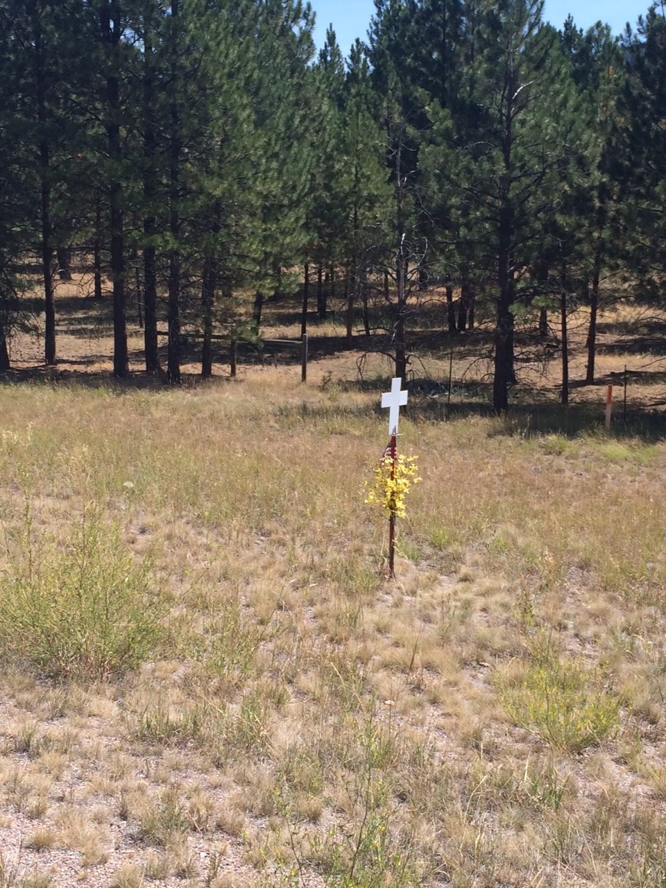
Since 1953 Montana has been erecting traffic fatality markers where people have been killed on the state's roads. Part of the idea was to reduce highway deaths by raising awareness of the problem. By one measure it has not done well. Montana had the third highest highway fatality rate of all the states in 2013. Today I took pictures of all of the traffic fatality markers I saw and I have posted them below. I probably missed some. The first three pictures concern one accident in which two high school freshmen girls were killed by a 29-year-old man who had taken prescription painkillers and had been drinking. The remaining photos are posted in the order in which I saw them. Most of the fatalities involved people in cars and a few involved pedestrians. A global movement has arisen to memorialize cyclists killed on roads by means of ghost bikes-a bicycle painted white, sometimes with a placard.